Representing Racialized Spaces in the DH World

How can new spatial mapping and mobile-device technologies be utilized to expose the history of race and place to the general public? I’d like to propose a discussion about the complex connection between technology and the representation of racialized spaces. Historical markers for significant sites associated with slavery populate the South but few acknowledge the lives and contributions of enslaved and free African Americans. Is it possible to create a multifaceted, easily accessible digital map of African-American settlements, travel routes, and cultural markers associated with the historic spaces such as Fort Hill plantation that is designed for GIS-enabled mobile devices? What are the advantages and disadvantages of using a mobile app to make this type of history visible and accessible? — Rhondda Thomas, Clemson English


Exploring the Connection between Social Media and Genre Construction

I propose a session wherein we explore ways genre can be constructed in a social situation. Normative definitions of genre (stemming from, but not exclusively, Aristotle) have had their own share of noted and notable problems; as a result, genre theorists have turned to descriptive accounts of genre makeup. I would turn away from a descriptive model framed only by critics, but instead from a broader look at reader response to particular works. In particular, I want to look at ways that Goodreads, as a social media expression of the kinds of books being read in the real-time now, can change the way we look at genre construction. What kinds of data can be useful in talking about genre? How might the tagging of particular works within genres change the way those books are read and received? What are the limits regarded the use of crowd-sourced data regarding the tagging of books?

Finding and Using Aerial Photographs for GIS


Pamela Mack, Clemson History


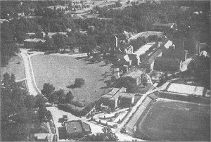
I propose a session on finding and using aerial photographs (back to the 1930s) and satellite images (back to the 1970s) for GIS.  I can share a little of the history of aerial and satellite photography and show some of the places where they can be reliably found.  But an equal priority is conversation about the uses of aerial and satellite photography to illustrate and analyze historic landscapes.

Clemson_1930s

What Does the Library Need to Do to Support DH Projects?

What Does the Library Need to Do to Support DH Projects? By  Camille Cooper

When faculty and graduate students conceive of a DH project, do they think about their library’s resources, both material and human, as sources to consult?  If not, why not?  I’d like to talk about ways to determine what needs are out there and then ways to effectively communicate what it is the library can do to meet those needs.

Wearable devices: challenges and opportunities

Wearable_Technology_DemandWearable computing has received growing attention in the media, market and scientific research in the past decades. There are new devices available each day and they provide a lot of new opportunities for applications. Available in many different form factors, wearable devices aid to support not only gaming, fitness and fashion, but also safety critical and medical emergencies.

Glasses help to quickly access information, document life events through photos and videos, receive notifications and alerts, etc. Intelligent armbands aid to keep track of activities, including: eating and sleeping habits, and physical exercises.

Although wearable devices provide a lot of new opportunities, they are not (yet) widespread. Users may be concerned about privacy issues, or do not see clear benefits of these devices, perhaps their costs are still too high.

Better understanding what users (or potential users) think about wearable computing, can help to improve the design of these devices, and consequently to meet users’ expectations.

A Template for Mobile App-Guided Tours

A Template for Mobile App-Guided Tours
Roy Pargas, School of Computing

We propose developing a template for a mobile app promoting tours of an area, such as a campus.  The tours may focus on the history of the area, the architecture of the buildings, the flora and fauna, the academic layout, a sports complex, a nature preserve, tourist information, or any other theme.

The app will feature text descriptions, images, video clips, audio podcasts, links to websites,  interactive maps, and navigational aides. Geofencing (using GPS to determine where the client is at the moment) will provide alerts when the client enters a special area.  GPS tracking will enable the client to remember where he or she has been.
An authoring tool will enable administrators to provide new or additional content regarding points of interest (waypoints) in the area.  Administrators can add text, images, video, audio podcasts, links to websites to a database in the cloud.  As soon as new content is added, the client’s app will download the information and make it available for viewing.
A feedback feature will allow a client to enter text and take pictures, video, or audio of items of interest.  This information can be uploaded to the database and administrators can make the artifacts available to other clients or use the information for internal administrative purposes.
The app will be able to recognize markers on special sites and will automatically provide the client with information pertinent to the site.
The template will be generic and can be used to develop apps for a wide variety of areas.
Those interested in contributing to specific versions of this project, in particular regarding the Clemson campus, are invited to discuss and contribute; other proposals for mobile apps are also always welcome.

==================================
Dr. Roy P. Pargas
Division of Human Centered Computing

Reducing barriers to current scholarship in support of future research opportunities

Copyright restrictions can be significant barriers to digital humanities projects. I would like to chat about the current scholarly communication system, and ways that we can reduce these restrictions while making our research openly available via the web.  By working together to ensure that our current scholarship remains accessible and repurpose-able, we can greatly expand the future possibilities for work in this field.

Glass Explorers

Jan Holmevik, Sean Morey, and I want to meet with other THATCampers to chat about Google Glass, the opportunities it might create for teaching, learning, and research; future app development; and more. The three of us are new Google Glass “explorers” and so will be ready to share our experiences thus far.

Just In Time Research Help

In a time of information saturation, students and faculty have no trouble finding information…but it is the RIGHT/BEST information? How do they go about getting help from their friendly librarians? Do they know that librarians are out there?

I propose a session to talk about ways that librarians can help create just in time research help for students and faculty. I’ll talk about the things that we’re trying out here at the Clemson Libraries…everything from online classes to tutorials to video tours to live chat…and I’d love to hear what other folks are up to in the provision of just in time help.